RDC Fitchburg Technology Campus Phase II

COMMUNITY OVERVIEW

The City of Fitchburg, conveniently located within minutes of Madison, provides the best of city and rural life, with a diverse population of more than 25,000 residents and over 700 businesses. Centrally located within the greater Madison region, with a population of 568,593, Fitchburg is a short commute to either the east or west sides of Madison, University of Wisconsin-Madison, and the State Capitol. Fitchburg is nestled within 22,000 acres of rolling hills, parks, and family farms as well as other unique recreational opportunities including world-class bike trails. 
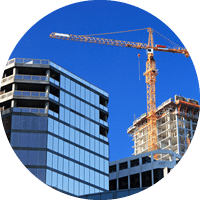
With advanced manufacturing making up 9% of the local workforce, Fitchburg is a center of innovation and good ideas. The city is well-represented by knowledge-based companies in such industries as biotechnology, thermoforming, information technology, medical instrumentation, nanotechnology, and agriculture. The easily accessible RDC Fitchburg Technology Campus Phase II is within minutes of commercial activity and area amenities including restaurants, hotels, entertainment, transit stops, housing, and parks.

Site Features & Contact

No significant topography issues

Roadway access

No utility easements that would prevent development

Rail access

56.79 contiguous acres not affected by wetlands

Commercial airport access

No known environmental impediments to immediate industrial development

Freight airport access

No known archaeological/historical impediments to immediate industrial development

56.79 contiguous developable acres

No known impediments to immediate development related to endangered species

American Land Trust Association (ALTA) survey

Fire insurance classification rating 3

Site not located on or adjacent to flood plain

Industrial zoning

Flight path certifications not proximate of any airport

Single owner with documented willingness to sell

Kyle Adams
Ruedebusch Development
4605 Dovetail Drive
Madison, WI 53704

608.243.9070

kylea@ruedebusch.com
WANT TO KNOW MORE?

Community Intro

Requirement Comments

Community overview

  • General community fit for industrial activity
  • Fitchburg is a suburb of Madison immediately south of the Highway 12/18 Beltline – Population: 25,000; Manufacturing comprises 9% of local workforce
  • Tech, light industrial, residential – known as tech area for Madison
  • Commercial activity on Highway 12/18 and on Fish Hatchery, including hotels and restaurants to serve the park
  • Good access
  • Click here for a Fitchburg community overview

Site environment overview

  • General surroundings fit for industrial activity
  • Biotech (Promega), Data Center, Light tech industrial, research, office
  • Quite a bit of residential adjacent to northern site boundary – highly visible
  • Promega owns their own sites and park adjacent (360 acres)
  • Generally well-developed, but existing companies and surroundings limit use

Roadway access

  • Proximity to interstate and other highways providing convenient access for labor and logistics
  • Access roads in place to site, or plans in place to extend access road(s) to site
  • South on Fish Hatchery Road from Highway 12/18 South Beltline interchange. About 3.5 miles of good street access to the Beltline along commercial strip (mostly 4 lane)
  • 10.5 miles along Highway 12/18 Beltline to I-94/39 interchange to the east
  • Access to the park is high-quality, well-lit and easily services the park
  • New US 14 interchange opened in 2014, providing access from the east
  • Click here for more information on road access

Rail Access (if applicable) – not required

  • Feasibility of service (if site is to be marketed as rail-served)
  • Not applicable

Commercial Airport Access – Access to airport(s) with commercial air service

  • Driving distance to proximate commercial airport(s) and overview of service available
  • Dane County Regional Airport on northeast side of Madison is 12.1 miles from the site (through Madison) and 17 miles from the site (around Madison) – less than 30 minutes in traffic (12/18 to US 51 north)
  • About 1.5 – 2.0 hours to Milwaukee Mitchell (90 miles)
  • About 2.5 to 3 hours to O’Hare

Freight Airport Access – Access to airport(s) with freight air service

  • Driving distance to proximate freight airport(s)
  • Description of the handling capacity of each proximate freight airport (e.g. current tonnage/year, runway length)
  • Same as above
  • Dane County Regional proposed as most useful for freight service from this location

Site Intro

Requirement Comments

Master Site plan and/or site plan illustrating exact dimensions and number of parcels for the specific site being submitted for certification

  • Minimum of 20 contiguous developable acres
  • 56-acre development features 23 developable acres remaining:
    Lot 1: 1.61 acres (70,266 sq. ft.)
    Lot 2: 1.50 acres (65,316 sq. ft.)
    Lot 3: 1.69 acres (73,649 sq. ft.)
    Lot 4: 2.56 acres (111,301 sq. ft.)
    Lot 22: 4.79 acres (208,667 sq. ft.)
    Lot 23: 4.75 acres (206,726 sq. ft.)
    Lot 25: 5.93 acres (258,370 sq. ft.)
  • Click here for the site plan

Aerial photograph illustrating the specific site being submitted for certification as well as the surrounding properties

  • Several high-quality recent aerials from multiple vantage points as well as site plan drawings were submitted
  • Ag land to the south seems logical future expansion so possible to get larger, although purchase and zoning process could be lengthy
  • Click here for the aerial image

ALTA Survey (American Land Trust Association) inclusive of site being submitted for certification

Flood Plain map (FEMA-produced FIRM map)

  • No part of the site may be located on (or directly adjacent to) a flood plain

Flight path specifications (if site is within 2 miles of an airport)

  • Documentation (letter or map from FAA) indicating any restrictions related to airport proximity
  • Not proximate (within 2 miles) of any airport

Ownership – entire site must be wholly controlled by a single owner with documented willingness to sell to an industrial user

  • Certificate of title
  • Letter from property owner/option holder stating that site is for sale/ lease

Asking Price – current asking price for sale or lease of the land must be indicated

  • Documentation of asking price on a per-acre basis
  • $239,580-$283,140/acre ($5.50-$6.50/sq. ft.)
  • Price negotiable based on lot size and location
  • Will build to suit lease-back

Topography – no significant topography issues that could present major obstacles to industrial development of the site

  • Topographic map with clearly defined contour intervals of 2’ or less
  • Topo Map submitted – Gently rolling site typical of the area
  • Site preliminary graded in 2014 in conjunction with road construction

Easements – site not intersected by utility or any other easement that would prevent development of 20 contiguous acres of the site

  • Maps of all utility infrastructure directly proximate to (or intersecting) the site
  • Maps of all utilities submitted

Wetlands – demonstrate that a user can utilize 20 contiguous acres that are not affected by wetlands

  • Wetlands delineation report conducted on the site, demonstrating that impacts to protected waters will be avoided (or approved mitigation plans)

Environmental Assessment – no known environmental impediments to immediate industrial development

Geotechnical – minimum of 5 soil borings (for 20-acre site); no presence of sink holes or limestone caves; suitable water content/water table depth

  • Completed August 2012 – 9 borings conducted on site; 15 ft. deep
  • Borings encountered lean clay/clayey silt underlain by dense sand to the termination depth
  • Groundwater encountered in 4 borings in SW section of site at 11-13.5 ft. below ground
  • Click here to download more geotechnical information

Archaeological/Historical – no known archaeological/historical impediments to immediate industrial development

  • McGaw Park Neighborhood Plan references the Cultural Resources Study conducted on the area inclusive of the site in 2009; the executive summary in the Plan provides a concise summary of the study findings that no obstacles to development were identified on or immediately proximate to the site (relevant study sections submitted)
  • Click here to download more archaeological historical information

Endangered Species – no known impediments to immediate industrial development related to endangered species

  • McGaw Park Neighborhood Plan references the Threatened, Endangered, and Special Concern Species Study conducted on the area inclusive of the site in 2009; the executive summary in the Plan provides a concise summary of the study findings that no obstacles to development were identified on or immediately proximate to the site (relevant study sections submitted)

Fire Protection

  • Fire Insurance Classification Rating
  • Distance to the nearest servicing fire department
  • Class 3; 1.7 miles from the Fitchburg City Fire Department

Zoning

Requirement Comments

Industrial zoning (or equivalent) currently in place, or zoning change procedure underway as of field investigation

  • Zoning certificate and relevant ordinance; or, letter from municipal authorities communicating status of zoning change procedure as of field investigation date
  • I-S Specialized Industrial District – permits offices, R&D, and certain specialized manufacturing establishments that are nuisance-free; limits manufacturing to small-scale products not exceeding 50 pounds; building height limit of 42 ft.
  • Draft covenants submitted; includes application plans and approval, development standards, building standards, landscaping, etc.

Surrounding area zoning – zoning of surrounding properties compatible with industrial development of site

  • Comprehensive Plan of area (if applicable)
  • Zoning map of area including site (if applicable)
  • Existing/planned zoning of surrounding land
  • Codes, Covenants, and Restrictions on site and surrounding sites, as applicable

Electric & Gas Utility Infrastructure

Requirement Comments

Proximate electric power infrastructure availability and capacities

  • Utility maps indicating location and current size/capacity of proximate transmission lines, distribution lines, and substations; Available capacity that could be provided to the site for each of the above
  • ATC controls transmission and substations, MG&E controls distribution (and also owns generation assets)
  • 8-10 MW capacity available to the site from two separate substations
  • ~1 mile SW to Oak Ridge substation served by 138KV transmission line and 2 37 MVA transformers; ~50% capacity; underground distribution to site
  • ~3 miles NE to Syene Road Substation served by 138KV transmission line and 2 37 MVA transformers; ~50% capacity; aerial distribution to site
  • 13.8kV transmission line with 8 MW capacity runs to SW corner of site
  • All underground service in the park
  • Coal, gas, wind and some co-gen generation. Mostly coal, but new is gas or wind
  • Click here to download the site electric information
  • Click here to download more utility structure information.

Detailed description of dual feed potential (current or proposed redundant service)

  • Overview (and map) illustrating dual feed electric service routes, including location, size and capacity of each node of delivery (substation, distribution line, etc.)

Introduction of any proposed improvements to/extensions of electric service to the site

  • Cost, timing, and funding responsibility of any improvements required to provide proposed service to the site

Proximate natural gas infrastructure availability and capacities

  • Utility maps indicating location and current size/capacity of proximate transmission lines, distribution lines, delivery points, etc; Available capacity that could be provided to the site for each of the above

Introduction of any proposed improvements to/extensions of natural gas service to the site

  • Cost, timing, and funding responsibility of any improvements required to provide proposed service to the site

Proximate water and wastewater infrastructure availability and capacities

  • Utility maps indicating location and current size/capacity of proximate mains, distribution lines, lift stations, etc; Available capacity that could be provided to the site for each of the above
  • Water: 10” ~20 psi main at western site boundary and 8” ~20 psi main at northern site boundary are available to serve the site; both will be looped
  • Total system pump capacity is 6.9 MGD; current peak day demand is 4.2 MGD
  • 1,200 GPM water well serves the area; 500K gallon water tower serves the park (gravity fed in park); total system storage capacity is 2.25M gallons, currently ~60% utilized
  • Wastewater: 10” main stubbed at NW corner of the site, 8” main stubbed at northern site boundary; these two lines will be looped to connect the broader system, but the configuration is flexible
  • Site served by Woods Hollow Interceptor, available capacity of 720 GPM (peak)
  • Click here to download more water utility information

Introduction of any proposed improvements to/extensions of water and/or wastewater service to the site